The Drawdown - East End
OK, so by now you understand that I've spent a lot of good times down at the SAB. It is time to start getting into the recent drawdown of the river.
I read about it on some web site (MinnPost?) and saw a few pics and was fascinated. Luckily I was slated to go down and pick up my youngest son (yes the cute little guy from the previous page) at THE U of M. His dorm is just a couple miles from the SAB, so I left early and spent a couple hours wandering around the river bed. It was just as cool as I had hoped it would be.
We'll start with the east end of the SAB. There is a park on the East side that is part of St. Anthony (the other side of the river is Minneapolis). This is the spot where I took the pictures of my boys with their carp that you saw on the previous page.
I'm going to try to juxtapose pics of the drawdown with pics I took a month later. Unfortunately the pics of the "normal" level were taken in early December so the water isn't as high as it normally would be in summer. You should, though, be able to see what a difference the water makes.
So take a look at the pics. You can see bigger versions by clicking them.
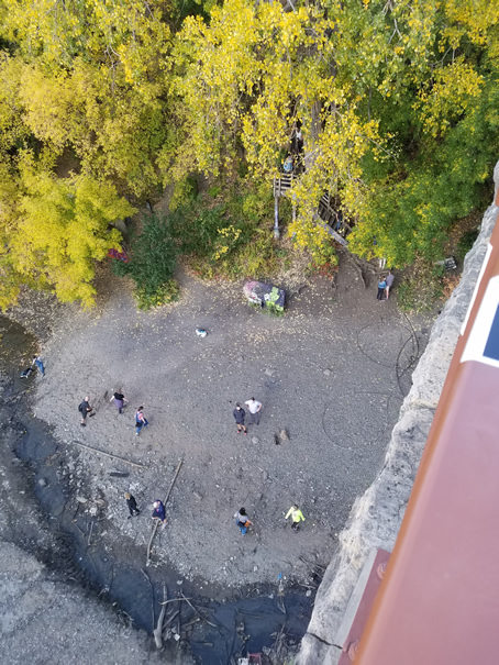
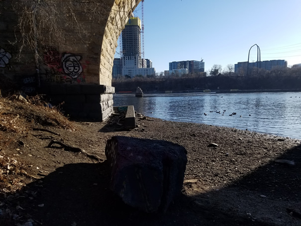
This is the bird's eye view of the spot the boys and I were standing at in the previous page. The big rock
they were sitting on is at the top of the screen (base of the stairs). In the normal level pic, the
shadow of the pier cuts through it. You can see how much further up the beach the water level is.
In the drawdown pic on the left you can see that there is a very deep channel not too far from
the normal water's edge. You can also see the edge of the railing that the nannies put in when
they opened the bridge up to the public.
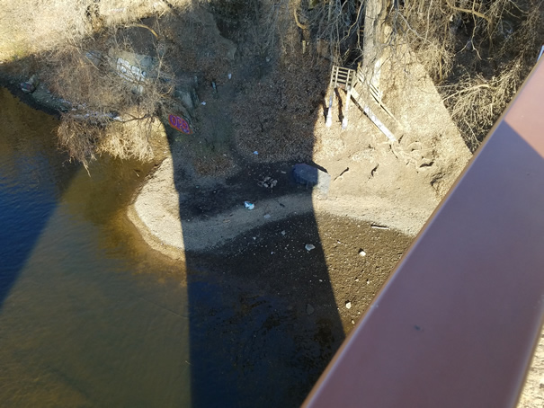
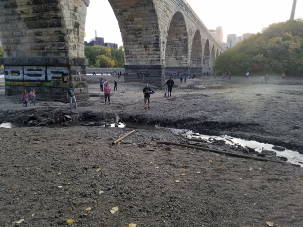
The next set of pics are of the base of the SAB on the east end. This is what you would see if you
were down carp fishing and looked to your left (South). The guy on the drawdown side is walking in
front of a small cement wall. On the right you can see that his feet would be pretty wet if he tried
that again.
If you came to this spot in the summer when the river is running higher, the water would have been
right up to that cement wall. A lot of times both sides of that wall will be flooded and people walk along
the top of it.
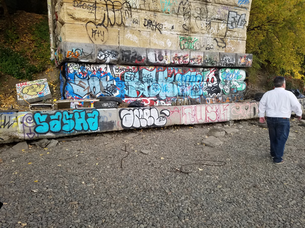
It is hard to tell in the normal pic, but the graffiti is still there. One of the side effects of
the drawdown was that it attracted every jerk with a spray paint can. There was always some graffiti
down there, but nothing like it is now. The big rock my kids were sitting on is now covered with crap
from some tagger.
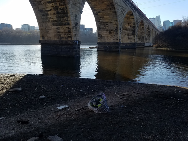
These pics show the base of the SAB from our usual carp fishing spot. This is pretty much from the
big rock that the boys were sitting on in their picture.
You can see the deep channel in the foreground of the picture of the drawn down river. You can also
see that the people walking at the base of the bridge's piers would be pretty wet normally.
Below are a lot more pictures of the drawdown from around the East end of the bridge. You can see bigger versions by clicking them.